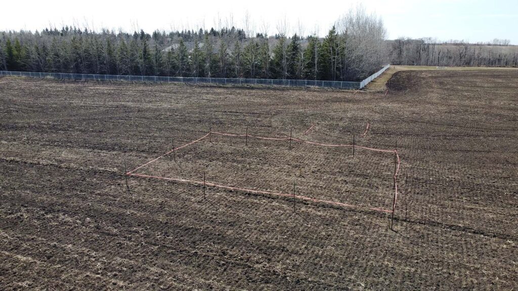
Like all projects, this one started by staking out the site where the foundation would be placed. Here, I have marked out the rough rectangular footprint for the observatory.
Of course, the telescope will be precisely aimed towards celestial north so that it can track objects properly as they move across the sky, independent of the orientation of the building it is situated inside. But, geeky person that I am, for asthetic reasons I wanted the building aligned north to south as accurately as possible as well.
Back when we built our house 20 years ago, I had been experimenting with GPS receivers to see how accurate I could make positional measurements. I discovered that the Motorola VP Oncore OEM GPS receiver boards were relatively inexpensive and reported carrier phase along with other GPS satellite measurement data. From this, I went down the rabbit hole of discovering how precise satellite ranging information could be determined. With two GPS boards, one fixed at a known position and the other mobile, I was able to collect data at both stations simultaneously over a period of around 15 minutes, and then post process the data afterwards to determine the precise difference in position between the two stations, accurate to just a few millimeters. For no other reason than I thought it would be fun to do, I used the equipment and software I wrote to align our fence in a north to south line accurate to just a few millimetres over its 170 metre length. In other words, our fence line (of all things) is oriented to true north within about 0.0006 degrees (around 2.5 arcseconds).
It would have been ideal to use this equipment to orient the observatory as well, but 20 years is a long time in technology. The data logging software I wrote stored its data on PalmPilots (remember those?). iPhones were still several years away from being invented, and a PalmPilot was about the only real option for a small, mobile computer. So though I still have the GPS receiver boards, I don’t have an easy way to collect and post process the data any longer. Some day, I should redesign the system to record data to SD cards using the Raspberry Pi or Arduino so I can continue to use those tools, but there just isn’t enough hours in one lifetime.
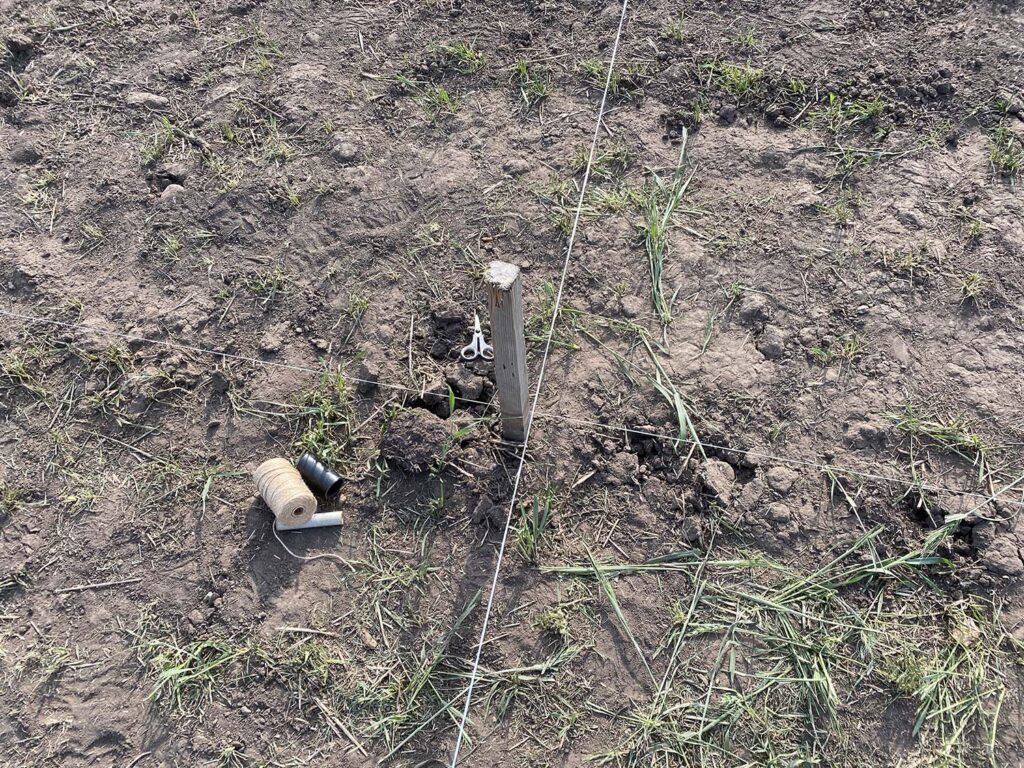
So instead, I used the fence as a relatively nearby north-south reference line. Though, as a result, the orientation of the observatory won’t be accurate to within a few millimetres, it should still be accurate to a centimeter or two. The string line in the photo below is my north-south reference. Stakes outside of the excavation were kept in place throughout the footing and foundation construction to ensure that the alignment held. Other stakes in the photo mark the various edges and corners of the excavation.
Finally, “X marks the spot” of where the centre of the telescope will be. Because the telescope will sit on a wedge that offsets its centre from the pier, the centre of the telescope does not mark the centre of the pier. But it is destined to be the centre of the dome when everything is constructed, and as such, all measurements for the footings and foundations are in reference to this point.